ប្រភពបញ្ហាទាក់ទងនឹង
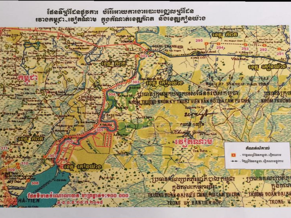
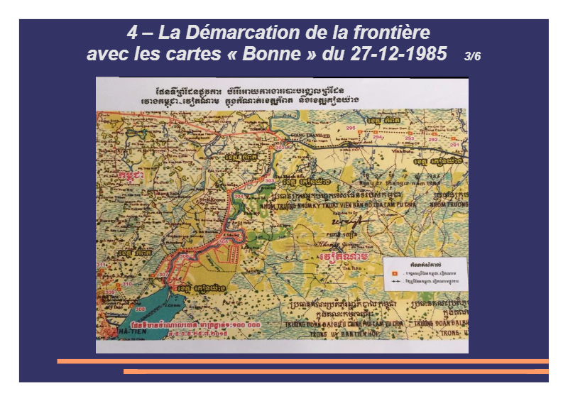
បង្គោលនិងខ្សែបន្ទាត់ព្រំដែន កម្ពុជា-វៀតណាម
ហេតុអ្វីបានជាគេបង្កើតផែនទីប្រភេទមួយថ្មី
ហើយមិនចេះមើល យកទៅប្រើមិនបានដូច្នេះ ?
[pdfjs-viewer viewer_width=0 viewer_height=800 url=http://193.29.57.123/wp-content/uploads/2017/02/page-de-garde-cause-des-problèmes.pdf download=true print=true fullscreen=true fullscreen_target=false fullscreen_text=”View%20Fullscreen” zoom=auto ]
សូមអានឯកសារ ជាភាសាខ្មែរ មួយសន្លឹកម្ដងៗ
[pdfjs-viewer viewer_width=0 viewer_height=800 url=http://193.29.57.123/wp-content/uploads/2017/02/Démarcation-de-la-frontière-du-Cambodge-avec-le-Vietnam-khmer-Battambang-1.pdf download=true print=true fullscreen=true fullscreen_target=false fullscreen_text=”View%20Fullscreen” zoom=auto ]
UN DOSSIER DE CAMBODGE INFO
[pdfjs-viewer viewer_width=0 viewer_height=800 url=http://193.29.57.123/wp-content/uploads/2017/01/La-démarcation-de-la-frontière-du-Cambodge-avec-le-Vietnam-3-français-10.pdf download=true print=true fullscreen=true fullscreen_target=false fullscreen_text=”View%20Fullscreen” zoom=auto ]
បើគេមិនបង្ហាញនិយាមកា (Coordinates, Coordonnées) បង្គោល ដែលបានបោះហើយឱ្យយើង យើងនឹងនាំគ្នាទៅស្រង៉យកនិយាមកា GPS បង្គោលនោះខ្លូនយើង !
Like this:
Like Loading...
Related


You must be logged in to post a comment.